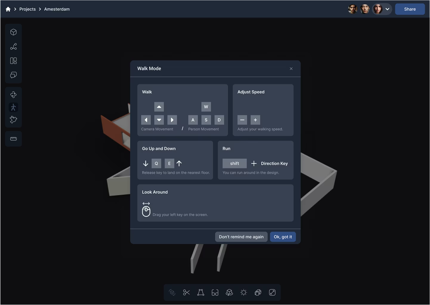
Walking Mode
Walking Mode for an immersive first-person experience inside models.
GeoVision is a cloud-based BIM solution for seamless collaboration and visualization. AEC professionals can share data via a plugin, interact with high-quality 3D models and leave element-specific comments. With infinite versioning, users can access project history and workflow data anytime.
Our team developed GeoVision to demonstrate our ability to deliver complex, scalable solutions for the AEC & BIM industries. GeoVision is an ecosystem combining real-time collaboration, advanced 3D visualization and seamless integration with industry-standard design tools.
Walking Mode for an immersive first-person experience inside models.
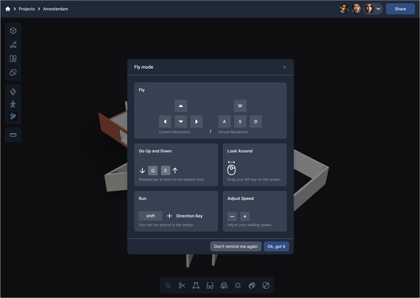
Fly Mode for intuitive navigation of large-scale projects.
«GeoVision leverages the capabilities of Speckle as a foundation for data interoperability, but we have significantly expanded its potential by adding proprietary enhancements tailored to industry needs.»